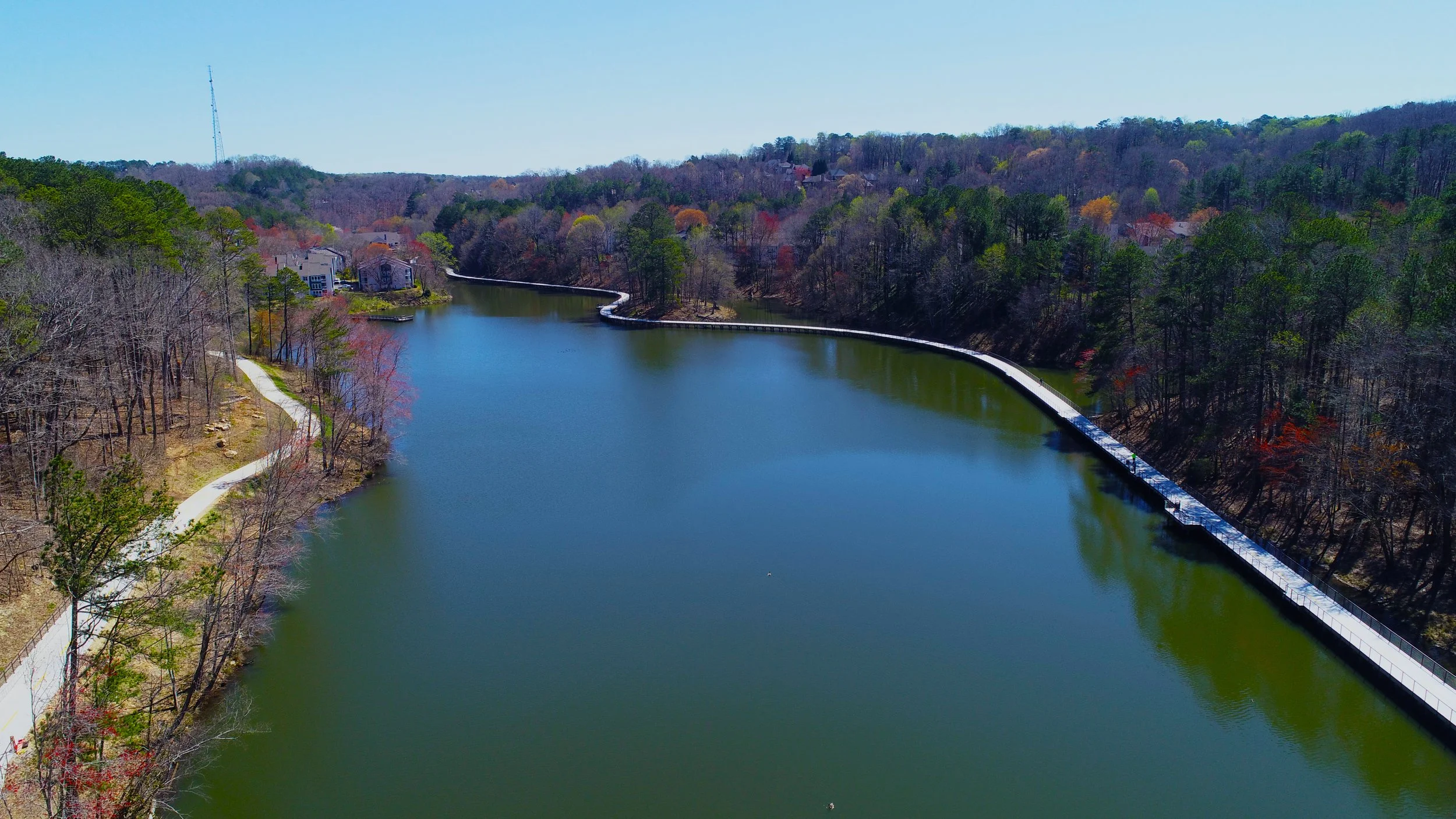
It’s hard to believe it’s been 2 months since the grand opening of the Springway Morgan Falls Connector! We’re incredibly proud to have led the design of this scenic 1.9-mile greenway in partnership with the City of Sandy Springs, the PATH Foundation, and the Sandy Springs Conservancy. From concept to completion, this project has been a rewarding collaboration—nothing tops seeing the community out enjoying the trail! The Springway stretches from Morgan Falls Overlook Park to Roswell Road, featuring a stunning ~3,000 LF boardwalk across Orkin Lake. If you haven’t walked it yet, now’s the time to see this beautiful blend of nature and design come to life.


Trails ATL progress report is available for public review and comment
The Trails ATL report is available for public review and comment until June 4, 2025.
Report DRAFT can be viewed here.
Visit Report — Trails ATL to leave comments/questions and learn more about the project.

Atlanta Beltline Northwest Trail Segment 1 Breaks Ground
Segment 1 of the Northwest Trail connects from Peachtree Park Drive to Kinsey Court, traversing through the Peachtree Park Apartments community. KAIZEN is proud to be the lead consultant on a dedicated design team to deliever this project for the Atlanta Beltline Inc and PATH Foundation.

The proposed suspension bridge over Peachtree Creek

Proposed trail access point and plaza at the end of Kinsey Ct.

Photo Source: Atlanta BeltLine, Inc. Atlanta Mayor Andre Dickens, Atlanta Beltline, Inc. President & CEO Clyde Higgs and other community leaders broke ground on Northwest Trail—Segment 1 on Oct. 31, 2024, marking the Beltline’s first expansion into this area of Buckhead.
Georgia Hi-Lo Trail Plan Released!
Georgia Hi-Lo Trail Inc. releases the plan for the 220-mile of trail to connect Greene, Hancock, Washington, Johnson, Emanuel, Bulloch, Effingham, and Chatham Counties. KAIZEN assisted the PATH Foundation and worked with Georgia Hi-Lo Trail Stakeholders to develop this extensive plan. The plan outlines the vision of the project, establishes the value of multi-use trails, and explains implementation phases and timeline.
Take a look at the final report from this link!

Ribbon Cutting at Firefly Trail Greene County
KAIZEN & PATH celebrate the ribbon cutting of the 6.3 miles of new Firefly Trail that connects Union Point to near the north border of Greene County through City of Woodville.


Celebrate the progress of our Tucker Trail Model Project construction!
Yesterday’s groundbreaking ceremony for Tucker Trail Model Project was a fantastic event! This is the start of a 31-mile network that will provide connections throughout the City of Tucker.
DeKalb County South Peachtree Creek Trail Study
DeKalb County, with assistance from the PATH Foundation, KAIZEN, and Alta Planning + Design team is studying ways to better connect our communities in District 2 with existing greenway trails like the South Fork Peachtree Creek Trail.
Click here for the Northern Study Area Survey or here for the Southern Study Area Survey.
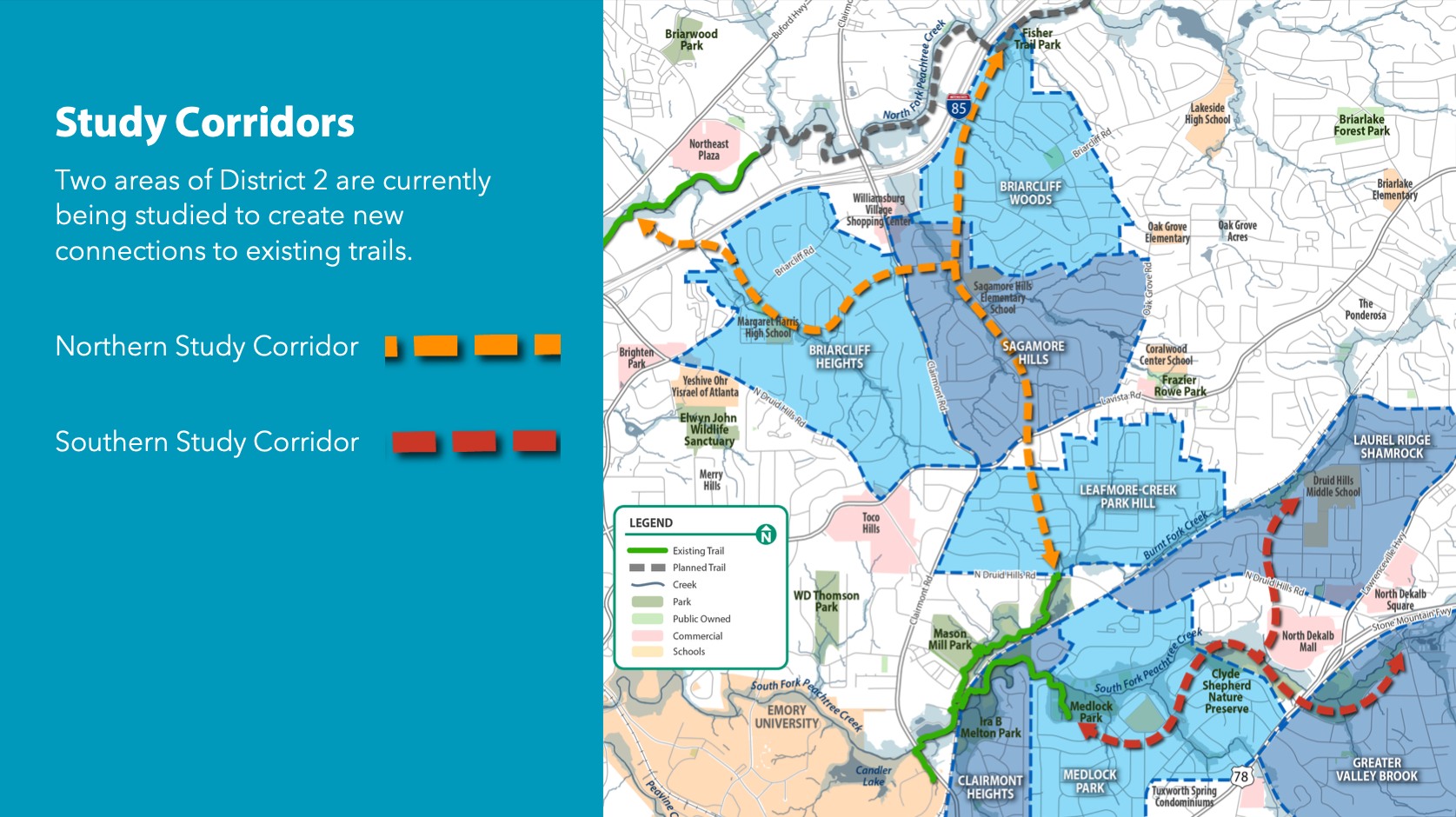

Image courtesy to Alta Planning + Design.
Carrollton Greenbelt - Southern Spur to Downtown
Thankful for PATH and their partners with City of Carrollton and Carrollton GreenBelt, we look forward to the southern GreenBelt spur to downtown opening early 2021!

Abutment installed for new trail bridge in Tanner Medical Campus

Trail under construction adjacent to the Cotton Mill Farmers’ Market

Trail crossing with RRFB system to be installed at Dixie Street
Westside BeltLine Connector - the 300th Mile of PATH Trails
Congradulations to PATH Foundation on pouring the 300th mile of PATH trail and inlaid the 300 Mile Marker on the Westside BeltLine Connector last week! Here are two shots of the fresh concrete—once the trail is opened, we'd love to see y'all in a picture with it. We look forward to seeing y'all's shining faces with it and to building our next 100 miles!


A shot took prior to the installing of the 300th Mile Marker, showing a bench pad laid out with pavers to be installed inside the concrete banding.

Signs installed on the new trail bridge over Boone Blvd south from the 300th Mile Marker
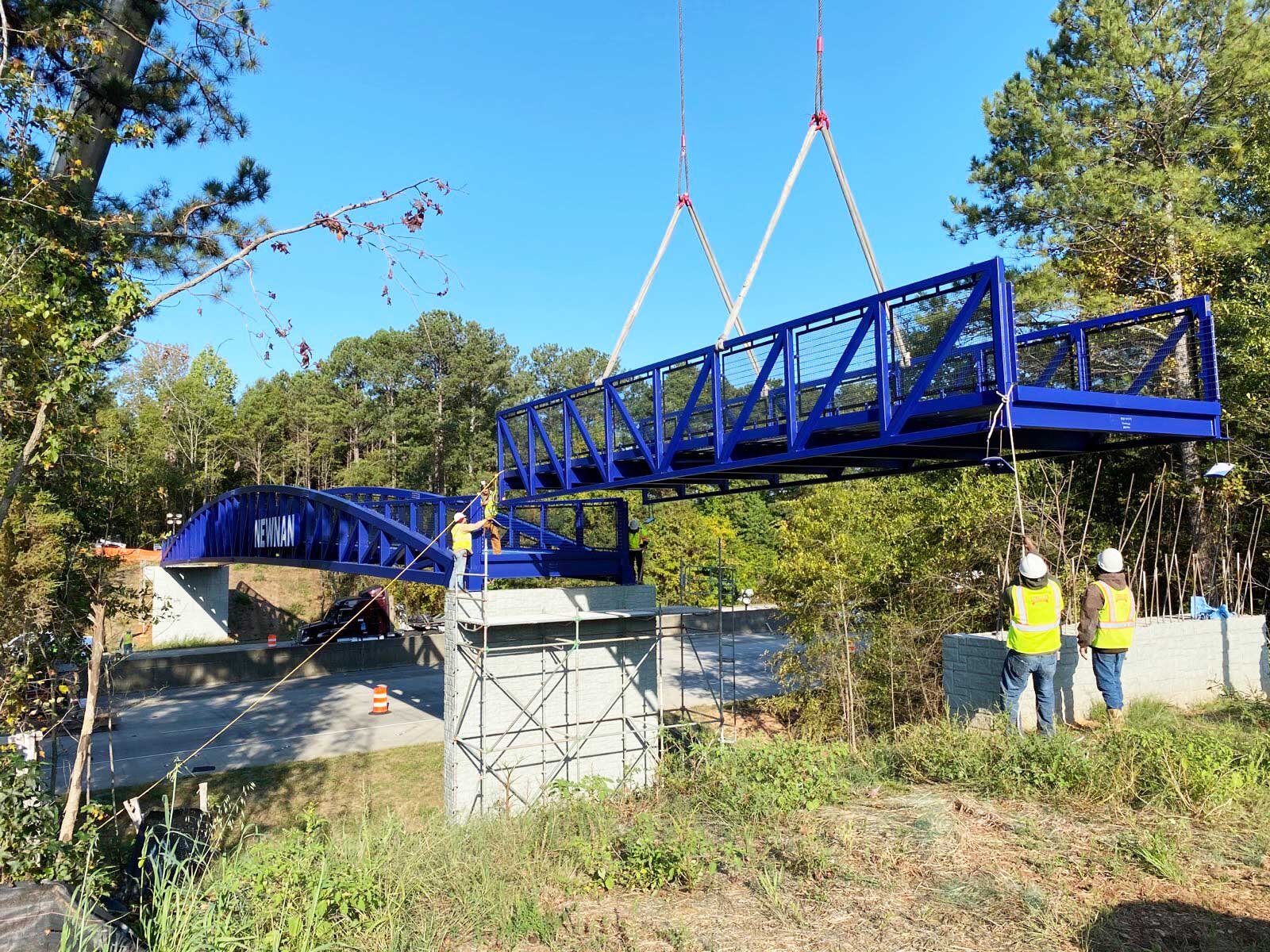
Newnan LINC Construction Update - the installation of Trail Bridge over I-85
The iconic LINC bridge has been installed in October! This is an exciting moment to have it as a connection between both sides of I-85.
The rest of the trail is expected to be finished by the end of this year. Stay turned for the ribbon cutting ceremony.